The data workspace handles record-level work without forcing geometry into every export.
Use the Attributes table for record-level work
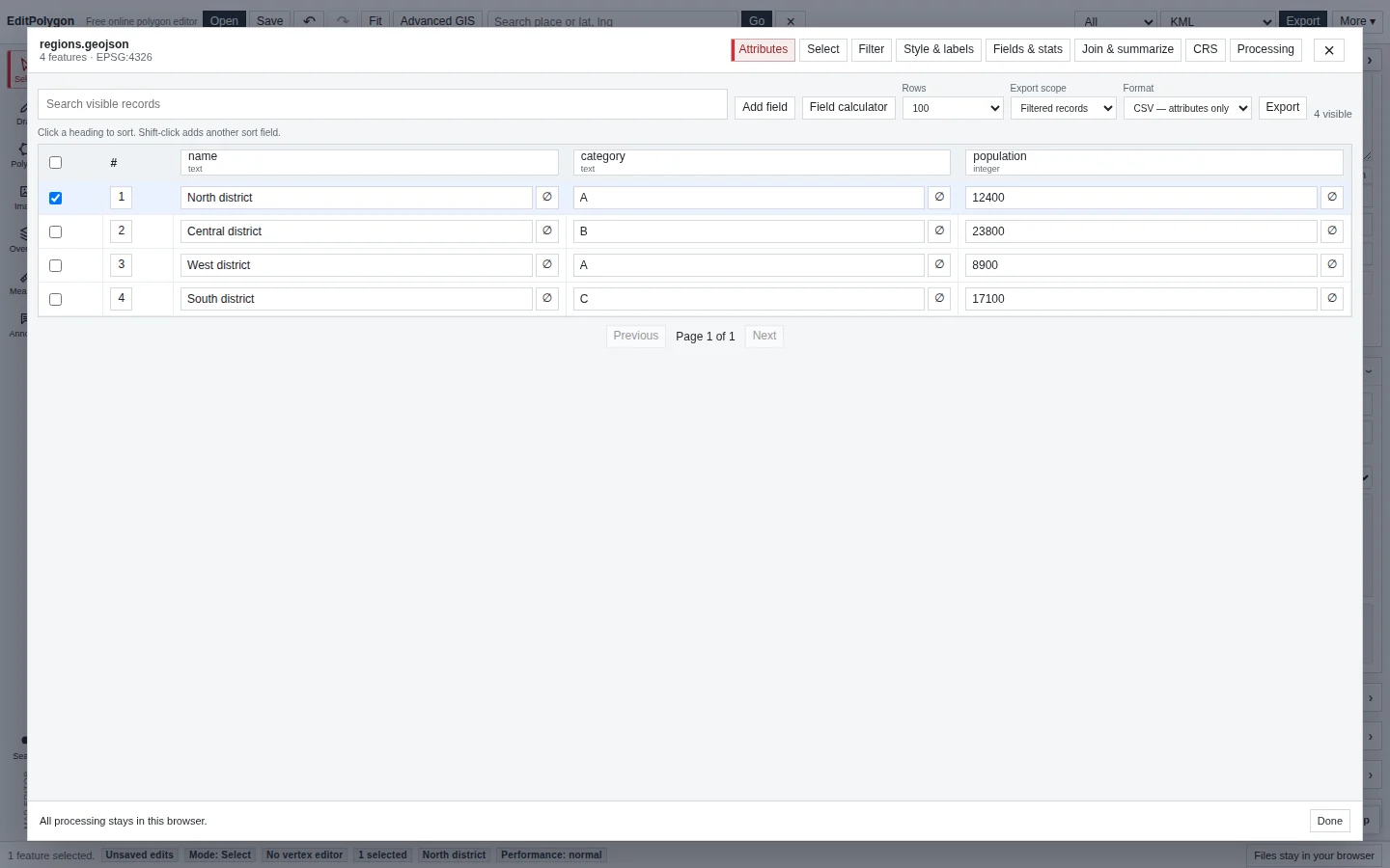
Open the Data/GIS window for an editable layer and choose Attributes. The table shows one record per feature and renders controls according to the layer schema rather than treating every value as untyped text.
Supported field types include text, integer, decimal, boolean, date and datetime. Read-only fields remain visible but cannot be edited. Changes made through the table use the same project data model as map edits.
Sort and inspect records
Click a column heading to sort. Shift-click another heading to add a secondary sort; the table displays the sort priority so multi-column order is explicit.
Use table search and the Filter tab for different purposes: table search is a quick view aid, while a layer filter is a reusable dataset condition that can also become the Filtered input scope in Processing.
Edit typed values safely
Edit a cell using the control appropriate to its field type. Numeric values remain numeric, booleans use explicit true/false controls, and date/datetime fields are validated before being written back to the layer.
If a value cannot be converted to the target field type, EditPolygon reports the problem instead of silently storing a misleading value.
Manage fields and schemas
Open Fields & stats to add, change or remove fields and to inspect the schema as a dataset rather than one record at a time.
- Add a field.
Choose a field name, optional alias, type, nullability and default value as appropriate.
- Preview type conversion before changing an existing field.
EditPolygon reports values that cannot be converted so you can decide whether to cancel, clean the data or explicitly replace invalid values.
- Review read-only/system fields.
Fields that are not intended for direct editing remain protected.
Check filters, styles, labels, joins and calculations that depend on the old field before making a structural change.
Calculate a field
The Field calculator evaluates an expression against records and previews the prospective output before applying it. Choose the output field and type deliberately so a numeric calculation does not become text data.
Use calculator preview to catch invalid expressions or incompatible results before the complete layer is mutated.
Inspect field statistics
Fields & stats can summarise populated/missing values, unique values and numeric statistics such as minimum, maximum, sum, mean, median and distribution information where applicable. These summaries are useful before choosing classification breaks, a join key or a calculation rule.
Build compound filters
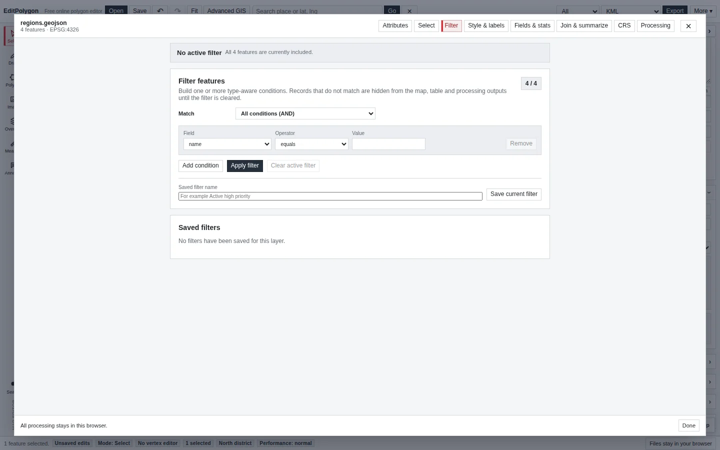
The Filter tab supports multiple conditions and AND/OR logic. Operators depend on the field and include normal comparisons such as equality, contains, greater/less than and range tests.
Save a useful filter when it represents a repeatable subset. Applying or clearing a filter updates the layer's filtered state without deleting records.
Export a normal spreadsheet CSV
The Attributes table has its own record export. Choose the record scope you need, then select the format:
One row per record with ordinary attribute columns and no geometry column. Use this for Excel, Power BI and other table workflows.
Includes geometry as Well-Known Text. Use it only when the receiving system needs spatial geometry encoded in the CSV.
Use when the output must retain feature geometry as a normal spatial interchange file.
Use the main Export workflow when you are exporting GIS geometry by All, Selected or Visible project scope rather than a table view.
Complex polygons can create extremely long WKT values. Do not choose CSV + WKT merely because you want a spreadsheet—use CSV — attributes only when geometry is irrelevant.
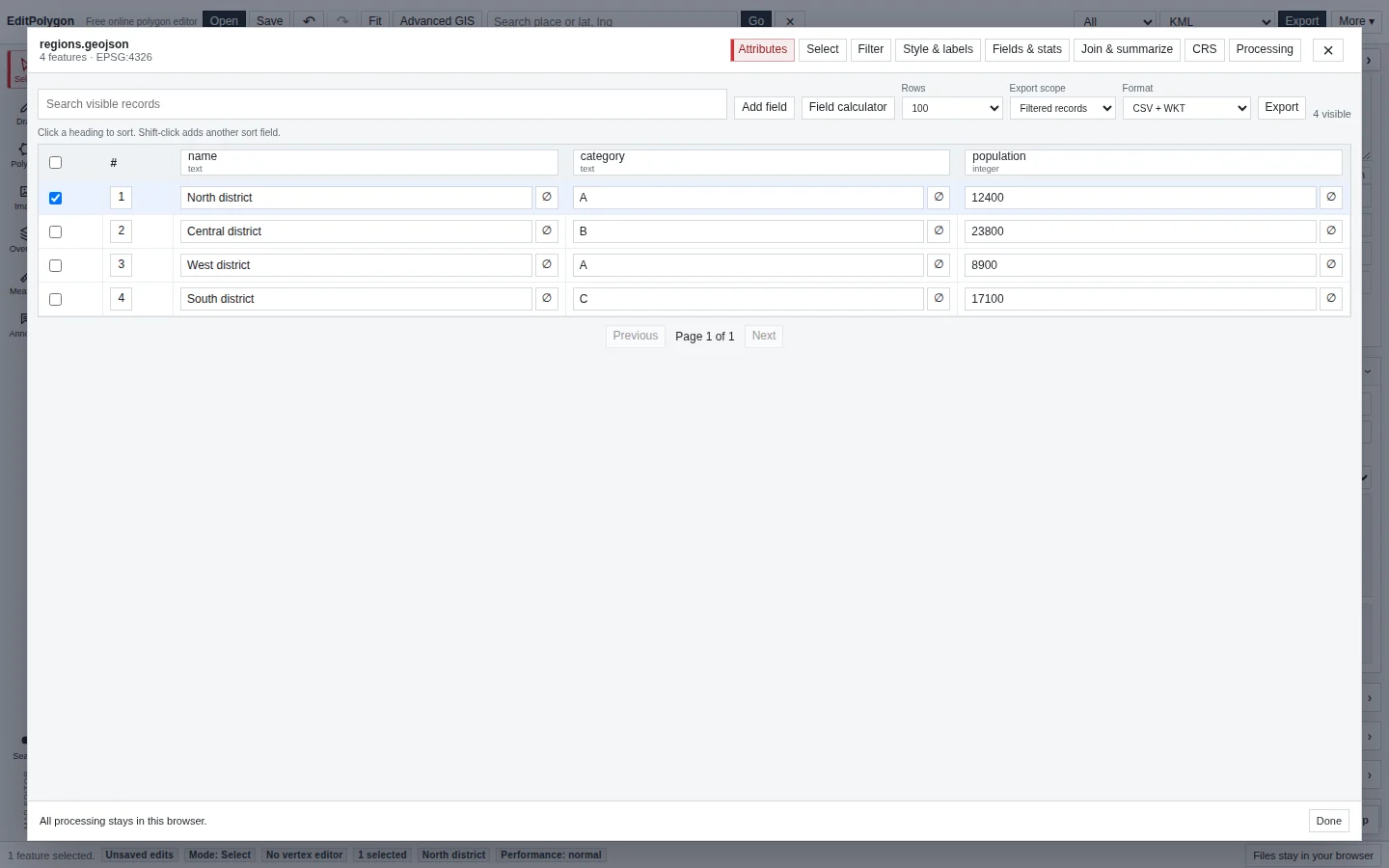
Table export and selective GIS export have different defaults
The Attributes table's CSV — attributes only and CSV + WKT are deliberately record-oriented exports. The main Export dialog's Geometry only default does not strip fields from this separate table-export workflow.
To share GIS geometry with only specific source attributes, open the main Export dialog or file converter, choose Preserve compatible data and tick the individual fields you want to keep. See Export data and save projects for script-like fields, external links and format-specific support.
Use joins when data belongs in another table or layer
Open Join & summarize for table-oriented joins and summaries, or use Processing → Join attributes by location when the relationship is spatial. The correct choice depends on whether records match by a key field or by geometry.
See Spatial joins and location queries for spatial relationships, multiple matches and one-output-per-match behaviour.
Undo, project state and downstream dependencies
Attribute and schema changes participate in the current project state and history where supported. Undo/Redo can restore earlier values or schemas, and the Data/GIS interface refreshes after a history restore rather than leaving stale phantom fields on screen.
Save an .epz project before a large schema migration or calculated-field operation that will be difficult to reconstruct from the source file alone.
- Field types describe the values you intend to store.
- Type conversion was previewed before a structural schema change.
- Compound filters represent the desired subset.
- Field calculations were previewed before Apply.
- Plain CSV rather than CSV + WKT was chosen when only attributes are required.
- Dependent styles, labels, joins and filters were checked after field changes.
Common questions
Can I work with attributes without exporting geometry?
Yes. The Attributes workspace supports record editing and attribute-only CSV export when the destination only needs tabular data.
Does applying a filter delete records?
No. A filter defines a working subset. It does not remove the underlying features unless you perform a separate destructive action.