GeoPackage import is browser-local; imported feature tables become normal editable project layers.
Open a GeoPackage directly
EditPolygon can read a local .gpkg file directly in the browser. It also recognises a GeoPackage inside a ZIP when the archive is passed through the local file importer.
Choose Open, use the Project drop area, or open Advanced GIS → Add data → Open GIS files. The importer identifies GeoPackage content before creating project layers.
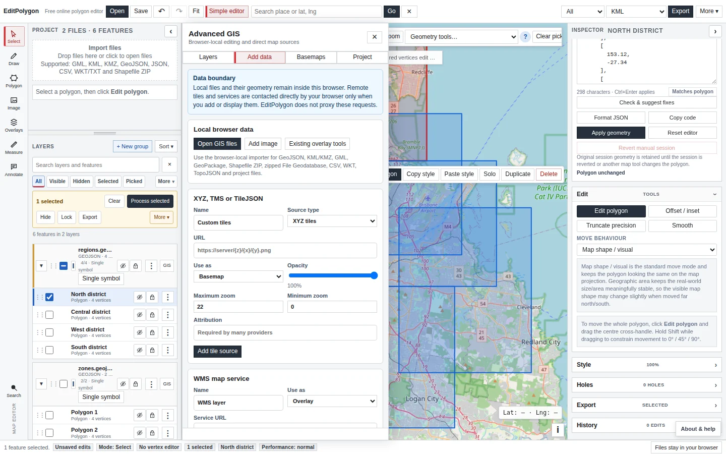
For local files, the GeoPackage bytes and imported geometry remain in the browser. Remote map tiles or services are contacted only when you deliberately display or add those remote sources.
Understand what happens to feature tables
A GeoPackage can contain more than one feature table. EditPolygon reads the available feature tables and materialises the vector features into the project. When multiple source tables are combined by the importer, the source-table identity is retained so records are not silently mixed without context.
Imported features then use EditPolygon's normal editable layer model rather than remaining bound to a live SQLite/GeoPackage database connection.
For the complete local format matrix, see Open and import GIS data.
Edit geometry and attributes
Select imported features to inspect or edit their attributes, use the Attributes workspace for table-level work, and use direct geometry editing for deliberate feature changes. Geometry code is available when you need exact coordinate structure rather than map-handle editing.
Because the imported layer is a normal project layer, you can also style it, filter it, select subsets and run Processing operations over All, Filtered or Selected features.
See Attributes, fields, filters and tables and Draw and edit geometry.
Review CRS before analysis
GeoPackage feature tables can carry coordinate-reference metadata. Review the source/native CRS in the layer CRS workspace before applying metric analysis or exporting to another coordinate system.
EditPolygon stores editable map geometry in its canonical geographic model while retaining source/CRS context for interpretation and export. The difference between assigning metadata and actually changing coordinate interpretation is explained in the CRS and reprojection guide.
Run GIS processing on the imported layer
GeoPackage-derived layers can participate in the same Processing Toolbox as other editable vectors. That includes geometry operations such as Buffer and Centroids; overlays such as Clip, Intersection and Union; aggregation such as Dissolve; spatial analysis; and geometry maintenance.
Use Preview before committing a complex result so the derived geometry can be compared with the source. Processing creates normal project output layers with provenance rather than rewriting the original GeoPackage file on disk.
See Processing Toolbox for the current catalogue.
Export the edited data in a supported output format
EditPolygon currently treats GeoPackage as an import format. After editing, export the required features to one of the supported GIS interchange outputs such as GeoJSON, KML/KMZ, GML, Shapefile ZIP, WKT, CSV or TopoJSON, depending on geometry and destination requirements.
If you need to preserve the complete EditPolygon workspace—source-derived layers, Processing outputs, styling and project state—save an .epz project separately. See Export data and save projects.
Preserve selected fields without recreating the source database
Import retains supported GeoPackage feature-table geometry, attributes and relevant source-table identity. Original SQLite schema, domains, relationships, attachments and auxiliary package metadata are not fully represented by the editable project.
Geometry only is the default for exports from the imported layer. Choose Preserve compatible data to include selected fields in a supported output such as GeoJSON or Shapefile ZIP. An .epz saves retained EditPolygon state, but neither it nor a GIS interchange export recreates the original GeoPackage database. See the format compatibility guide.
Common GeoPackage questions
Does EditPolygon edit the original .gpkg database in place?
No. It reads supported feature tables into the browser project. Editing changes the EditPolygon project model, not the original GeoPackage file on disk.
Can one GeoPackage contain several layers?
Yes. GeoPackage is a container format and can hold multiple feature tables. The importer handles that container structure rather than assuming one file equals one feature layer.
Can I export a new GeoPackage?
Not currently. GeoPackage is supported for import; use one of the supported interchange export formats for the edited result.
- The expected feature tables were found during import.
- The imported layer geometry and attributes look correct.
- The source CRS was reviewed before metric Processing.
- Changes were made to the project layer, not assumed to update the original database.
- The result was validated where geometry changed materially.
- A supported export format or .epz project was chosen for the required output.