Use direct editing for feature-specific changes; use Processing for repeatable layer operations.
Choose direct editing or Processing first
The current editor deliberately separates interactive feature editing from repeatable GIS processing.
Use when you are drawing a feature, moving known vertices, managing holes, splitting one active polygon, smoothing one polygon, offsetting one polygon or changing exact geometry code.
Use when the same operation should run consistently over All, Filtered or Selected features, when two layers participate in an overlay, or when you need an auditable derived layer.
For example, Simplify, Densify, Snap, Dissolve, Union, Intersection, Clip and Fix geometries are Processing algorithms. The Geometry tools dropdown exposes a convenient Dissolve selected polygons… shortcut, but that shortcut opens the authoritative Processing tool rather than maintaining a second dissolve implementation.
Draw new geometry
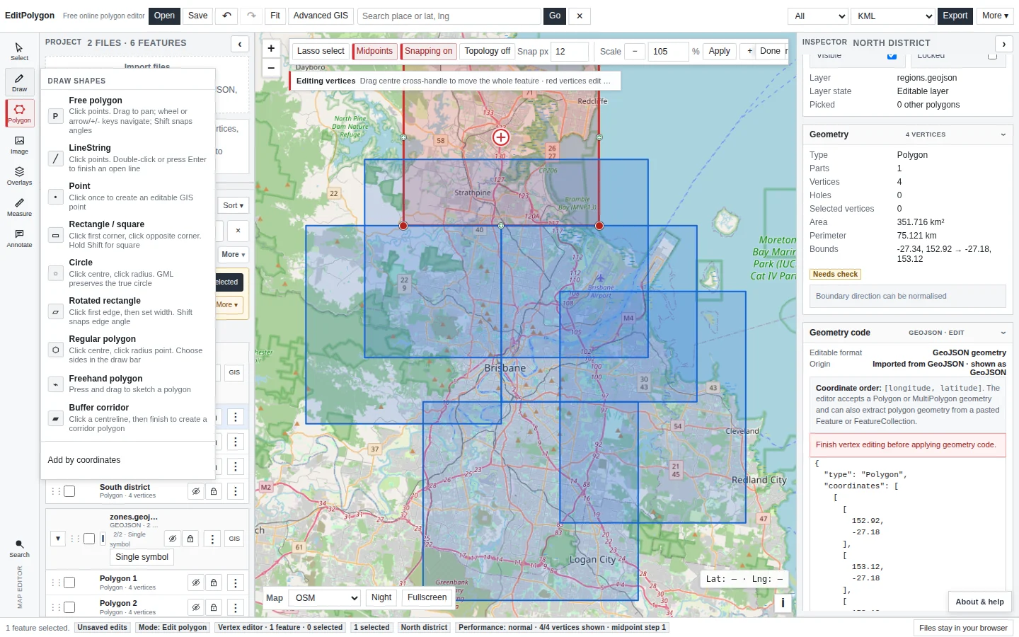
Open Draw from the left tool rail. The current draw menu includes:
- Free polygon — click boundary points and finish the ring.
- Point — create an editable GIS point.
- Rectangle / square — choose opposite corners; use Shift for a square.
- Circle — choose a centre and radius point; GML can preserve it as a true circle.
- Rotated rectangle — define an edge and width.
- Regular polygon — define centre/radius and side count.
- Freehand polygon — press and drag to sketch.
- Buffer corridor — draw a centreline and create a corridor polygon.
- Add by coordinates — paste known latitude/longitude points.
Edit polygon vertices
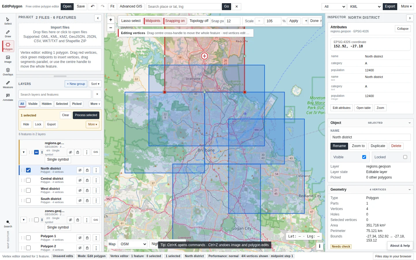
Select a polygon and choose Edit polygon. Existing vertices become draggable handles and midpoint handles allow a new vertex to be inserted between two existing coordinates.
Work at a useful zoom. A visually small drag at statewide scale can represent kilometres on the ground. Use Undo immediately if the resulting boundary is not what you intended.
Use snapping and topology deliberately
Snapping helps a moved or newly created coordinate align with nearby geometry. The global Snapping control can be toggled, and Alt temporarily disables snapping during an interaction.
Topology can move coincident vertices in other visible editable polygons. Enable it only when those boundaries are intended to be shared. It is not a substitute for checking the data model: overlapping hazard zones, for example, may legitimately have independent boundaries.
Direct snapping assists your current edit interaction. Processing → Snap runs a GEOS-based operation over an explicit input scope against a reference layer and supports a non-destructive preview.
Edit exact geometry code
Open the Inspector's Geometry code section for the active feature. It shows an editable GeoJSON geometry object and applies changes through the normal project history.
The editor supports the normal point, line and polygon families: Point, MultiPoint, LineString, MultiLineString, Polygon and MultiPolygon. Confirm the type and coordinate nesting before applying a replacement.
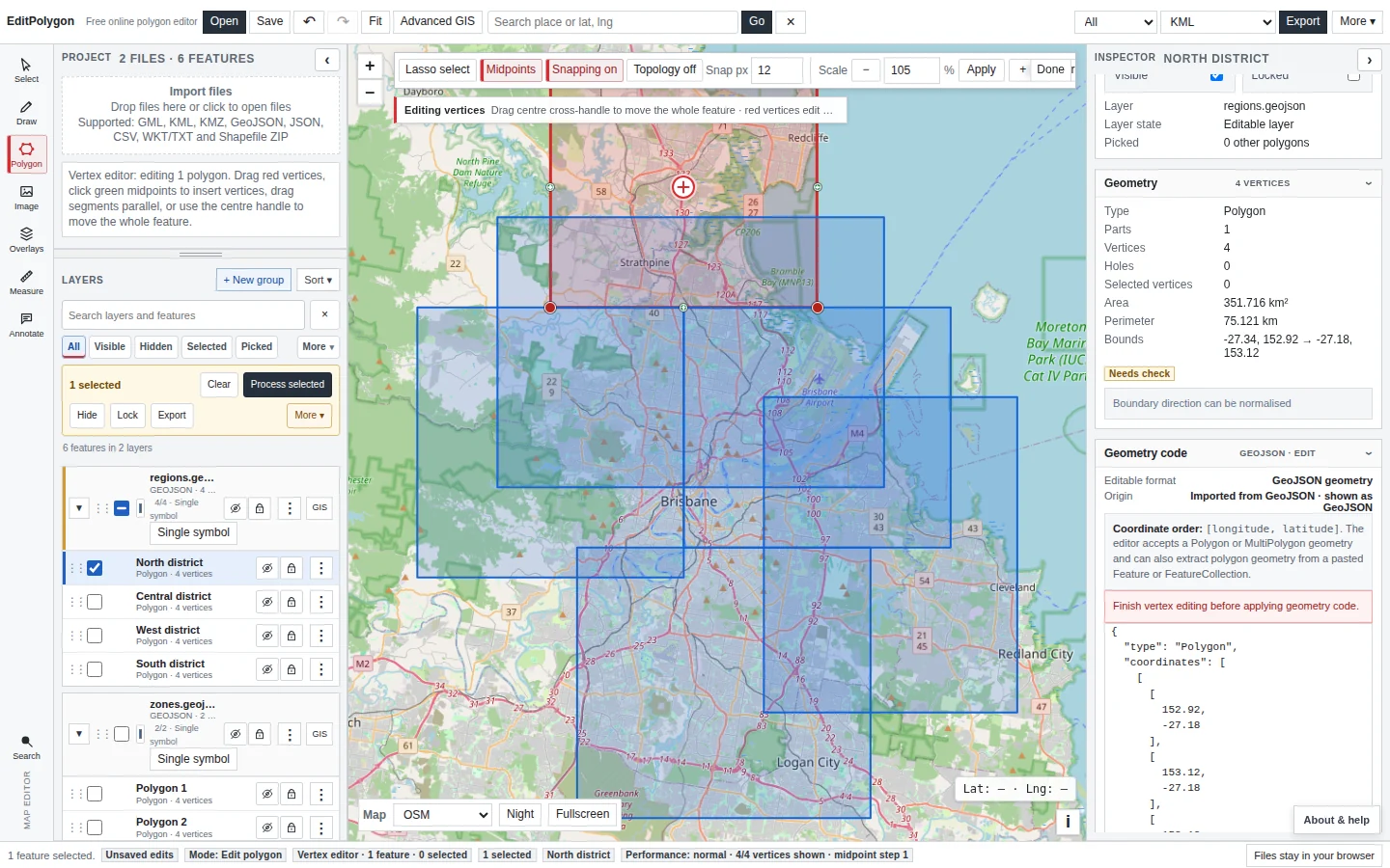
A syntactically correct coordinate array can still contain a self-intersection, collapsed component, invalid hole or wrong coordinate order. Run Geometry Health after consequential manual code changes.
Use the quick Geometry tools menu
The floating toolbar's Geometry tools (quick)… menu is intentionally smaller than the Processing catalogue. It contains interactive operations for an active polygon, plus a shortcut into Processing:
- Offset / inset active.
- Truncate precision active.
- Dissolve selected polygons… — opens Processing → Dissolve with the selected scope preconfigured.
- Split active by drawn line.
- Draw hole in active.
- Hole manager active.
- Convert picked polygons to holes.
- Fill all holes in active.
- Smooth active.
- More geometry tools… → — opens the full Processing Toolbox for the active spatial layer.
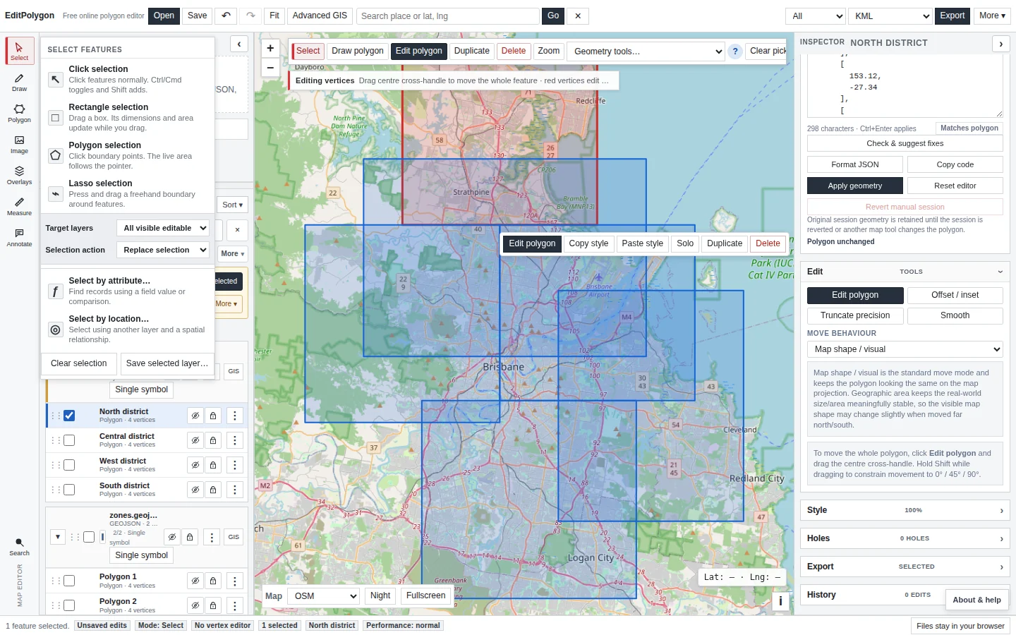
If the operation you are looking for is not here, check Processing before assuming the feature was removed.
Split one active polygon by drawing a line
Splitting remains a direct map-editing operation because the cutting line is an interactive user input.
- Select the polygon.
Confirm the intended active feature in the Inspector.
- Choose Geometry tools → Split active by drawn line.
- Draw a clean line across the polygon.
Start outside, cross the polygon and finish outside the opposite boundary. Avoid tracing an existing edge.
- Review the preview/result.
Inspect new parts and any holes or narrow slivers around the cut.
See Split a polygon with a drawn line for the focused workflow.
Manage holes
A polygon can contain interior rings. Use Draw hole when you need to create an exclusion, or Hole manager to locate, inspect, delete or convert individual holes. Fill all holes is intentionally broad—use it only when every interior ring is known to be unwanted.
After merge, split or repair operations, inspect holes again. A hole can be both geometrically valid and operationally wrong.
Points and lines
Points created with the Draw tool are normal editable GIS features. Line geometry imported from supported formats also participates in the current Inspector, Geometry code, styling, attributes, selection and Processing workflows. Processing tools automatically restrict inputs to compatible geometry families.
For example, Points along line and Line → points accept line inputs, while Polygon → line accepts polygon inputs. The Processing form reports incompatibility before execution rather than silently coercing unrelated geometry.
Validate after structural changes
Run Check & fix geometry after manual code replacement, difficult vertex edits, splits, hole manipulation or other structural changes where validity matters. Geometry Health can locate repeated coordinates, collapsed geometry, ring problems, self-intersections and other issues, then separates safe cleanup from repairs that need review.
- The correct feature is active before a direct edit begins.
- Snapping/topology are enabled only when the intended data relationship requires them.
- Feature-specific Geometry tools are not being confused with Processing algorithms.
- Geometry code nesting and coordinate order were checked before Apply.
- Undo is available if a direct edit has an unexpected result.
- Structural changes were validated before authoritative export.
Common questions
Can I edit polygon coordinates exactly instead of dragging vertices?
Yes. Use Geometry code for exact GeoJSON geometry editing, or Add by coordinates when you are creating a polygon from a known geographic coordinate list.
Should I use map editing for a layer-wide geometry operation?
Usually not. Direct map tools are intended for feature-specific edits; repeatable layer-wide operations belong in the Processing Toolbox.