Visibility, filtering and selection are separate states; use each deliberately.
Start with the four independent layer states
Most GIS mistakes in a complex editor come from treating visibility, filtering and selection as if they meant the same thing. EditPolygon keeps them separate deliberately.
Controls whether a layer is drawn on the map. Hiding a layer does not remove its features from the dataset and does not automatically change Processing membership.
Controls map presentation for individual features where that control is available. It is not a query.
Defines a record subset using attribute conditions. Filtered scope can be passed explicitly to Processing and table workflows.
Marks particular feature IDs for editing, export or Selected-scope operations. A feature can be selected even though a different filter or visibility state exists.
Use the Project and Layers sidebar
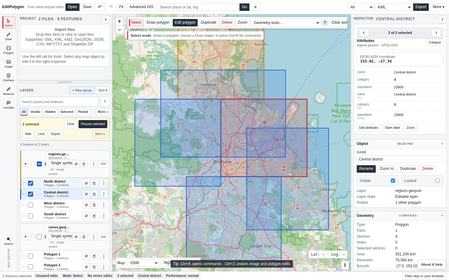
The simple workspace keeps local editing fast. Imported files appear under Project/Layers, and the Inspector follows the active map object. Use this sidebar when your work is primarily opening files, selecting features and editing geometry.
Typical layer actions include showing or hiding a layer, expanding its features, selecting features, making a drawing group active and ordering data for map presentation.
Use Advanced GIS for unified layer management
Choose Advanced GIS when a project contains more than editable files. Its Layers tab manages basemaps, editable data, local reference/image layers and remote service layers in one place.
You can rename layers, change visibility, adjust opacity where applicable, change order and assign layers to custom groups. Only one basemap is active, while editable, reference and service overlays can coexist.
Moving a layer above another or hiding it changes presentation. Processing membership is controlled by the input layer and the explicit All, Filtered or Selected scope.
Select directly on the map
Open the Select flyout from the left rail. Four spatial interaction modes are available:
- Click selection for individual features.
- Rectangle selection to drag a box.
- Polygon selection to draw a selection boundary.
- Lasso selection for a freehand selection boundary.
The same flyout lets you choose the target layer(s) and the selection action:
- Replace selection — make the new matches the complete selection.
- Add to selection — keep the existing selection and add matches.
- Remove from selection — subtract matches.
- Keep only matching selected — intersect the current selection with the new matches.
Select by attribute or location
For repeatable queries, choose Select by attribute… or Select by location… from the Select flyout or use the corresponding Processing selection tools.
Select by attribute uses a typed field and comparison such as Equals, Contains, Greater than or Between. Select by location compares an input layer with another layer using relationships such as Intersects, Within, Contains, Touches, Overlaps or Disjoint.
A selection preview highlights prospective matches without changing the canonical project selection. Apply the selection only when the highlighted result is what you intended.
Build a filter when you need a reusable subset
The Data/GIS Filter tab can combine multiple typed conditions using AND/OR logic. Filters can be saved and reapplied. This is preferable to manually selecting hundreds of records when the subset has a repeatable data rule.
A filtered feature remains part of the underlying layer. Clear the filter to return to the complete record set.
Understand All, Filtered and Selected Processing scopes
Most Processing inputs expose three scopes:
Every eligible feature in the chosen input layer. Layer visibility does not reduce this scope.
Only records that currently pass the layer filter.
Only feature IDs in the current project selection for that layer.
The same project can be styled or hidden for presentation while still requiring complete analysis. Processing therefore does not infer membership from the map display.
Some selection tools intentionally offer only All and Filtered because their purpose is to create or transform a selection; the Processing form shows the scopes actually supported by each tool.
Example: analyse only part of a large layer
- Apply an attribute filter.
For example, retain only records in a chosen region or category.
- Open Processing.
Choose the required tool and source layer.
- Set scope to Filtered.
The preflight count should match the filtered subset.
- Preview or Run.
Changing visibility while the tool is open should not silently change that membership.
This is also a useful performance strategy: filter or select the data you actually need, then process that explicit scope.
Selection and export
The top toolbar can export Selected geometry. The Attributes table can also export a record subset. Confirm whether your goal is a spatial file, a selected subset, or a plain attribute table before downloading.
For a spreadsheet result from a spatial join, use CSV — attributes only in the Attributes table rather than including a huge WKT geometry column.
- You know which layer is active and which layers are merely visible context.
- A filter is being used for a repeatable data rule rather than as a substitute for map visibility.
- The selection contains only the features you intend to edit or process.
- Processing scope is explicitly All, Filtered or Selected as required.
- Changing map visibility is not being relied on to change analysis membership.
Common questions
Are hidden, filtered and selected features the same thing?
No. Visibility controls what is drawn, filtering defines a record subset, and selection identifies specific features for editing or scoped operations.
Does Processing automatically use only visible features?
No. Processing uses the scope shown in the tool form, such as All, Filtered or Selected, rather than treating map visibility as an implicit scope.