Reduce the amount of data you ask the browser to render or process at one time without changing the authoritative source unnecessarily.
Control the amount of work, not just the map zoom
Large GIS datasets stress several different browser resources: parsing, memory, map rendering, interaction hit-testing and geoprocessing. Zooming out does not automatically make a layer cheap to process, and hiding a layer does not remove it from an All-scope Processing request.
The safest strategy is to reduce the active working set deliberately while preserving an untouched source or project copy.
Import large local data deliberately
Keep the original source file and follow any large-layer import choices the app presents. When exact editing of every source vertex is unnecessary, an optimised editable representation or reference-style workflow can be more practical than forcing the browser to interact with every coordinate at full detail.
After import, check the reported source/optimised vertex counts or import metadata when available. An optimised representation is a performance decision and should not be confused with the authoritative original.
Metadata and full-resolution limits
The large KML/KMZ fast reader can extract bounded simple ExtendedData and inline style information without retaining the entire original XML. Additional original-file metadata inspection has an 8 MB limit; complex presentation elements and packaged resources may remain unavailable even when all visible geometry imports.
Optimised ArcGIS imports can retain their returned attributes while using server-generalised boundaries. Geometry detail and retained metadata are independent. Selecting Preserve compatible data later does not restore vertices or service structures that were never imported.
Keep an untouched copy of authoritative source data. For a compact shared output, retain the Geometry only default or choose only the necessary attribute fields rather than including every retained column.
Reduce unnecessary rendering and interaction
- Hide contextual layers you do not currently need to see.
- Keep very large layer trees collapsed when inspecting another dataset.
- Use a quiet basemap when dense vector layers are the focus.
- Filter to a meaningful subset before table-heavy work.
- Avoid opening or repeatedly formatting enormous geometry-code payloads unless direct coordinate inspection is necessary.
These choices improve interaction, but remember that presentation state does not by itself change Processing membership.
Use Filtered or Selected Processing scopes
For a large source layer, a precise filter is often the best way to define repeatable work. Build the filter once, verify its record count, then choose Filtered for the Processing input.
Use Selected when the subset is spatial/manual rather than attribute-defined. Use All only when the operation really should process the complete eligible layer.
Hiding 19,000 of 20,000 features on the map does not make All scope a 1,000-feature job. Use an explicit filter or selection.
Processing preview is adaptive
Preview is designed to help without turning every parameter change into an expensive full-layer operation. Lightweight tools and smaller scopes can support live refresh after Preview is activated. Large or expensive operations become stale when parameters change and require Refresh preview.
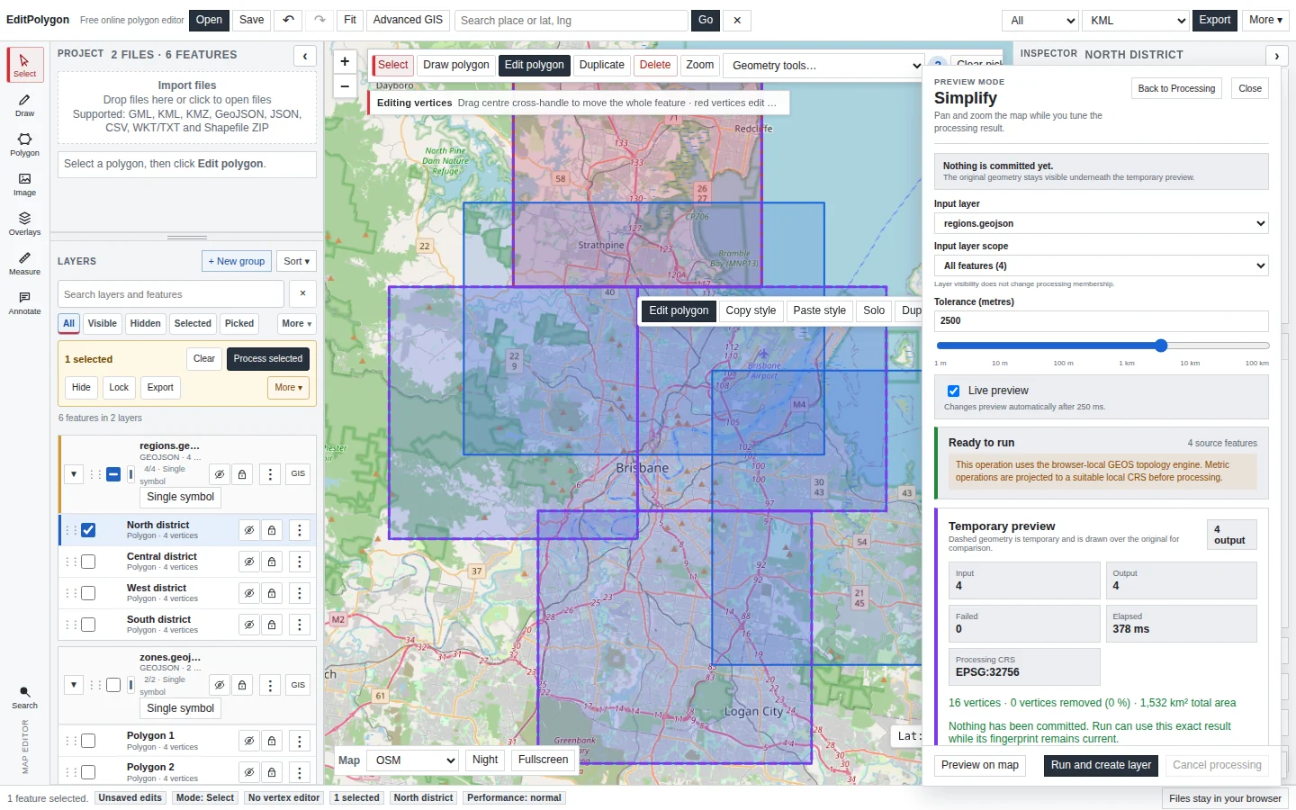
The map preview can cap the number of temporary features it renders for responsiveness while still computing the complete result. Read the preview notice rather than assuming the map displays every calculated output feature.
Choose algorithms with data size in mind
Operations have different computational characteristics. A per-feature centroid or attribute selection is not equivalent to dissolving thousands of overlapping polygons or performing a many-to-many spatial join.
- Per-feature operations scale mainly with the features/vertices in the chosen scope.
- Aggregate operations such as Dissolve or Convex hull need to consider the complete scoped set together.
- Two-layer overlays/spatial joins depend on both input sizes and their spatial relationships.
- Geometry maintenance can become expensive when individual features contain very large coordinate arrays.
Use the preflight counts to understand the request before running it.
Simplify only when loss of detail is acceptable
Simplification can reduce render and processing cost, but it deliberately changes boundary coordinates. Use Preview Mode, start with a conservative tolerance and inspect important edges at the map scale where the data will be used.
The Simplify preview reports vertex reduction so you can measure the change. A high reduction percentage is not automatically good; it may indicate lost operational detail.
Large spatial joins
Reduce both sides of a spatial join when the question permits it. For example, filter the source to one region and the comparison layer to relevant feature classes before asking for expanded one-output-per-match results.
If you need only counts or a numeric aggregate per source feature, Spatial summary or Count points in polygon can produce a smaller and more useful result than expanding every individual match.
Save checkpoints before expensive structural work
Download an .epz checkpoint before a large modify-source operation, schema migration or sequence of Processing steps that would be difficult to recreate. Undo is useful, but a project file is a more durable checkpoint.
Keep the original source outside the project as well when simplification, repair or conversion could change precision or structure.
Know when the browser is the limiting resource
EditPolygon intentionally performs local GIS work in the browser. That preserves a strong local-data boundary but means available memory and CPU are those of the current device. A desktop workstation and a phone can therefore have very different practical limits even though they use the same project model.
If the browser cannot hold or process the required authoritative dataset safely, pre-process the source in an appropriate high-capacity GIS/database workflow and bring the focused working dataset into EditPolygon.
- The authoritative source has been retained.
- Map visibility is not being mistaken for Processing scope.
- Filters/selections reduce the working set where the task permits it.
- Preflight counts are understood before expensive Processing.
- Large/expensive previews are refreshed explicitly rather than expected to run live.
- Simplification is used only when coordinate detail may legitimately change.
- An
.epzcheckpoint exists before difficult-to-recreate changes.
Common questions
What should I reduce first when a large project becomes slow?
Reduce the amount of data being rendered or processed at once by using appropriate visibility, filters, selections and Processing scopes before altering authoritative geometry.
Is there one fixed maximum dataset size?
No. Practical limits depend on browser memory, device performance, geometry complexity, vertex count, styling and the operation being performed.