Dissolve removes internal polygon boundaries; Union is a different two-layer overlay operation.
Use Dissolve when you mean “merge polygons”
In the current editor, repeatable merging of polygon features belongs in Processing → Dissolve. Dissolve removes internal boundaries from polygons in one input layer, either across the complete chosen scope or grouped by an attribute.
This replaces older documentation that treated polygon merging as a generic contextual feature action.
One input layer. Removes internal boundaries and optionally groups by a field. This is the normal “merge these polygons” workflow.
Two polygon layers. Builds a topological overlay and preserves attributes from both inputs. It is not simply a merge button.
Groups feature geometry into multipart records without dissolving boundaries.
Remain feature-specific map editing and are not substitutes for aggregation.
Define the polygons to dissolve
Use the source layer plus an explicit Processing scope:
- All when every eligible polygon in the layer should participate.
- Filtered when a repeatable attribute subset should be dissolved.
- Selected when you have manually/spatially selected the intended polygons.
If you need several separate merged outputs according to an attribute such as region or category, choose that field as the Dissolve field. Leave the field blank when the complete scoped set should be aggregated together.
Preview the dissolve on the map
Choose Preview on map. The temporary result is drawn over the original source so you can inspect which internal boundaries disappear and whether disconnected pieces remain.
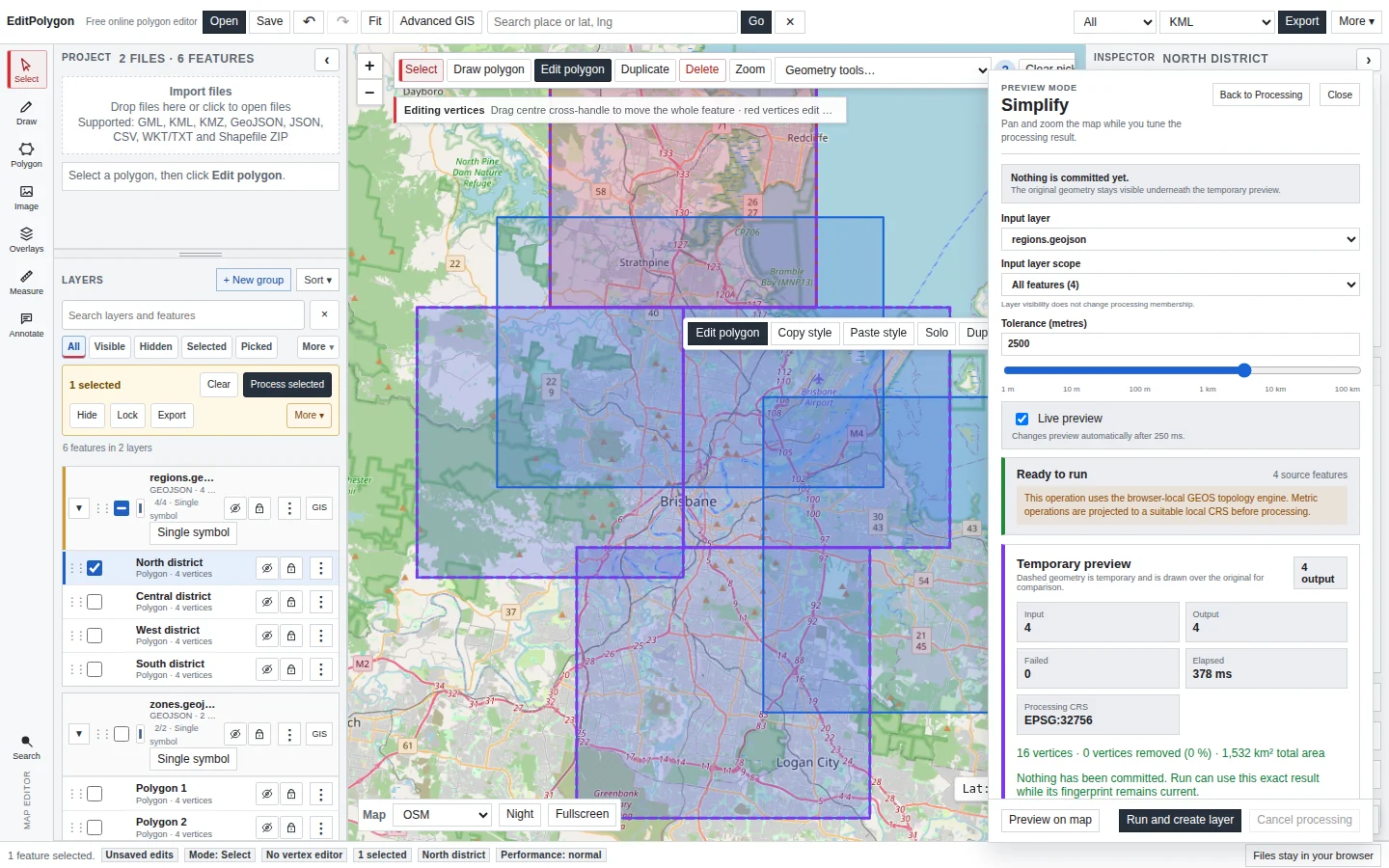
Pan and zoom while Preview Mode is active. Use Back to Processing when you need to change layer/scope/output configuration without discarding the current comparison.
Expect Polygon or MultiPolygon according to connectivity
Dissolve does not invent bridges across gaps. If the scoped areas form one connected dissolved region, the output can be a Polygon. If separated areas remain, the correct output can be a MultiPolygon.
A MultiPolygon result is not a failure. Forcing disconnected areas into one exterior ring would create false geometry.
Inspect almost-matching boundaries
Two polygons that appear to share an edge at statewide scale may actually contain a small gap or overlap. Dissolve can only remove boundaries according to the real source topology.
If the result contains unexpected slivers, gaps or holes:
- Zoom closely to the source boundary.
- Check Geometry Health where invalid topology is suspected.
- Use direct editing or Processing → Snap only if the boundaries are genuinely intended to align.
- Preview Dissolve again.
Understand attribute aggregation
Several input records become fewer aggregate records. No generic dissolve can infer the correct meaning of every source field. When dissolving by a field, that grouping value naturally identifies the result; other source attributes may require an explicit downstream decision.
If preserving both layers' detailed attributes is the goal, you may actually need Union or Intersection rather than Dissolve.
Run and create the output layer
Choose Run and create layer after the preview is satisfactory. Processing commits the result as a normal project layer with Processing provenance. The source layer remains available for comparison.
If a current preview fingerprint still matches the request, Run can commit that prepared result through the normal Processing commit path rather than calculating a different unseen result.
Validate a complex dissolve
Run Geometry Health on important or complicated dissolved output, particularly when source boundaries overlap imperfectly or contain large numbers of vertices. Validation should be followed by visual comparison with the source.
Export only the result you need
Select or isolate the dissolved output and choose the appropriate GIS export scope/format. Save an .epz checkpoint if the project contains source layers, Processing outputs and styling you will need later.
- Dissolve—not Union—matches the intended aggregation question.
- The correct layer and All/Filtered/Selected scope are being used.
- The optional dissolve field matches the desired grouping.
- The Preview shows expected internal-boundary removal.
- Polygon versus MultiPolygon output is topologically sensible.
- Gaps, slivers and holes were reviewed.
- The committed layer was validated where necessary before export.
Common questions
What is the difference between Dissolve and Union?
Dissolve aggregates polygon boundaries within one input according to the chosen scope or fields. Union is a two-layer overlay that preserves topological coverage from both inputs.
Why can a dissolved result become a MultiPolygon?
If dissolved areas remain spatially disconnected, one logical result can legitimately contain several separate polygon parts.