GIS exports are interchange files; .epz preserves the richer EditPolygon project state.
Separate GIS export from project save
EditPolygon has two different kinds of output because they serve different purposes.
Creates an interchange file for another system: KML/KMZ, GeoJSON, GML, CSV, WKT, TopoJSON or Shapefile ZIP as supported by the current export workflow.
Preserves richer editor/project state so the work can be reopened and continued in EditPolygon.
Do not rely on a GeoJSON or KML export to preserve every project-only state such as layer organisation, editor settings or other application metadata.
Geometry only is the default in the ordinary Export and Converter workflows. Choose Preserve compatible data to select individual attribute fields and detected identifiers, descriptions, colours, folders and safe source metadata. Only information retained during import can be offered, and the selected output format controls which categories are compatible. Script-like text and external links require a separate explicit choice and are never executed by EditPolygon.
CRS-aware downloads use the same Geometry only default and optional field selection. Attributes-table CSV remains an intentionally attribute-focused export; saving an .epz project preserves the richer editor state. GML true-circle exports retain their strict interoperable circle profile and may omit optional source fields.
Select exactly what to keep in an export
- Select scope and format.
The ordinary Export dialog covers All, Visible, Selected, Picked and Active layer where available. Only data in that scope is inspected for optional preservation.
- Leave Geometry only selected for a clean output.
It is the default each time you open Export. Optional original attributes, source IDs, styling and embedded content are omitted; formats may still need basic structural names or identifiers.
- Choose Preserve compatible data when needed.
EditPolygon detects available names, original IDs, descriptions, source styling, folders, source-document information and attribute fields. Only categories present in the imported project and supported by the output format can be enabled.
- Select individual fields.
The field list shows how many scoped features contain each field, including markers for complex or script-like values. Use Select safe fields or Clear fields, then tick only what your recipient needs.
- Review advisories and download.
Look for unsupported categories, earlier import losses, generalised geometry and format-specific conversions. Reimport or open the result in the destination GIS when accuracy or styling matters.
Script-like attributes and external links are separate explicit choices. Only compatible formats can retain scripts as inert property text; XML exports do not include executable content. Imported HTML descriptions are reduced to safe plain text, and EditPolygon never executes imported scripts.
Save an EditPolygon project
Choose Save in the top toolbar to download an .epz project. Use project saves as checkpoints before complex Processing, schema changes or major geometry edits.
Open an .epz later through the normal Open workflow. Project save is browser-local file generation; it does not require uploading the project to a server.
Use autosave as recovery, not archival storage
EditPolygon keeps browser recovery state and exposes Restore autosave under More. Autosave is useful after an accidental refresh or browser interruption, but it belongs to the current browser storage and can be cleared or become unavailable.
For important work, download an .epz checkpoint. Treat autosave as a safety net rather than the only copy.
Export geometry from the top toolbar
The top-right export controls choose the geometry scope first:
- All — export every eligible project feature covered by the export workflow.
- Selected — export the current selection.
- Visible — export the currently visible geometry according to the export model.
Then choose the GIS format and open Export. Verify the output filename, format-specific settings and feature count before downloading.
Choose the destination format based on the receiving system
Useful for KML-oriented map applications. Verify complex styles, folders, altitude and embedded resources separately.
Readable web/GIS interchange with standard feature properties and geographic geometry.
Useful when GML semantics matter, including supported true-circle representation.
Legacy multi-file GIS interchange packaged as one ZIP, with field/format constraints inherited from Shapefile.
Text/table workflows. Confirm CRS separately because raw coordinate numbers require a coordinate-reference interpretation.
Topology-oriented interchange for compatible receiving workflows.
Metadata support by output format
| Format | Supported preservation | Limitations |
|---|---|---|
| GeoJSON | Selected properties, available original IDs, small source-document metadata and style-hint properties. | Not every application renders style hints. Source-document metadata is an EditPolygon record, not a byte-for-byte reproduction of the source FeatureCollection. |
| KML / KMZ | Selected ExtendedData, IDs, safe plain-text descriptions, simple fill/line styles and source-folder grouping. | Complex StyleMaps, original nested folders, icons, tours, 3D constructs and archive resources are not fully recreated. |
| GML | Supported fields in EditPolygon extension elements for ordinary geometry. | Receiving systems may need a matching schema. Strict GML 3.2 exports containing true circles omit optional fields. |
| Shapefile ZIP | Compatible flat DBF attributes and available CRS through the CRS-aware workflow. | Field names become unique aliases of at most ten characters; nested values become text and original database structure is not recreated. |
| CSV | Selected columns and spatial CSV coordinates with geometry-part information in the main workflow. | Spreadsheet formulas are escaped; Attributes-table CSV is a distinct record-oriented workflow. |
| TopoJSON / WKT | TopoJSON can carry supported properties; WKT carries geometry only. | Neither is a substitute for saving an EditPolygon project. |
The file Converter and supported CRS-aware layer downloads also default to Geometry only and offer selective compatible data. Save a separate .epz project for complete retained editor state; it does not recover source data already lost on import.
Export records from the Attributes table
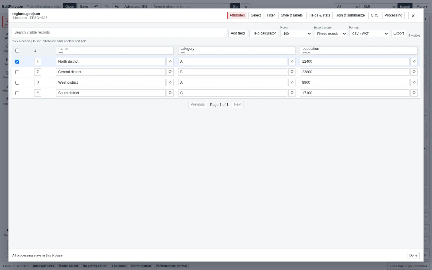
When the desired product is a table rather than a geometry file, open Attributes and use its record export.
Normal rows and columns with no geometry. Use for Excel, Power BI, lookup tables and expanded spatial-join relationships.
Adds a geometry column encoded as Well-Known Text. Use only when the receiving table workflow expects geometry.
Retains spatial geometry for the exported record subset.
Choose the table's available record scope deliberately—such as the current filtered subset—before exporting.
A complex polygon can produce an enormous WKT cell. Plain CSV exists specifically so geometry does not make an otherwise simple data export unwieldy.
Choose the output CRS independently of the map
GeoJSON, Shapefile ZIP, WKT and CSV support a selectable output CRS in the main Export dialog and standalone file Converter. The default remains WGS 84 (EPSG:4326). Choose GDA2020 / MGA, GDA94 / MGA, WGS84 / UTM or Australian Albers when the receiving system needs projected coordinates. Projection affects the downloaded coordinates only; it does not move the map or alter the saved project.
Projected GeoJSON includes legacy CRS metadata and should only be used where the receiving software supports that extension. Projected Shapefile ZIP includes a matching PRJ and UTF-8 CPG. Projected spatial CSV labels easting, northing and repeats its coordinate_crs so EditPolygon can reimport it without guessing. Plain WKT cannot embed a CRS, so record the selected EPSG code separately. KML/KMZ and ordinary GML/TopoJSON remain WGS 84 in the main export dialog.
Export in a required CRS
If the receiving GIS requires projected/native coordinates rather than the normal geographic project representation, use the layer's CRS tab to set and perform a CRS-aware export.
Do not simply label longitude/latitude numbers as another CRS. Reprojection changes coordinate values; assignment changes metadata only. See Assign and reproject a CRS.
Treat precision and simplification as data changes
Coordinate rounding, truncation and simplification can permanently change the downloaded geometry. Preserve full precision unless a receiving system or explicit data product requires otherwise.
If file size or rendering performance is the reason for reducing vertices, use Processing → Simplify with a map preview so the geometric consequence is visible and measurable before export.
Temporary Processing previews are not exported
Processing preview overlays are deliberately outside the project data model. They do not appear as Layers, do not enter Undo/Redo, are not saved in .epz and are not included in export. Run the Processing operation first when the preview should become a real output layer.
Why might some data be missing?
Verify in the destination system
After downloading an important output, open it in the actual receiving application and check:
- Feature count and geometry family.
- Required attributes and names.
- CRS/location.
- Holes and multipart structure.
- Coordinate precision.
- Format-specific presentation such as KML styles if relevant.
A successful download only proves that the file was generated; destination verification proves it is useful for the intended workflow.
- An
.epzproject exists if the EditPolygon work must be resumed later. - Autosave is not the only retained copy of important work.
- The correct geometry or record scope is selected.
- Attribute-only CSV is used when geometry is unnecessary.
- CRS and precision match the receiving system.
- Temporary previews have been Run when they need to become real output.
- The downloaded file was verified in its destination.
Common questions
What is the difference between a GIS export and an EditPolygon project?
GIS exports create interchange data for other systems. An .epz project preserves richer EditPolygon workspace state so the editing session can be resumed later.
Why should I check export scope before saving a file?
The chosen scope determines which features are written. Confirm whether the destination needs the whole layer or only the intended subset before exporting.