Use Draw → Add by coordinates when the boundary vertices are already known instead of tracing them manually.
Use Add by coordinates when the vertices are already known
If you already have a boundary as a list of latitude/longitude vertices, you do not need to trace it manually on the map. Open Draw → Add by coordinates and paste the known points to create the polygon.
This is useful for operational areas, supplied corner coordinates, simple areas of interest and other boundaries where the coordinate list is the source of truth.
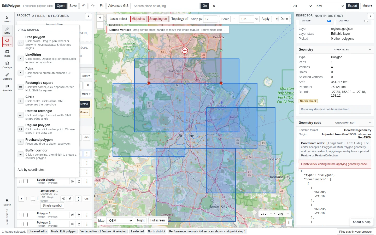
Check latitude/longitude order before creating the polygon
The Add by coordinates workflow is for geographic latitude/longitude points. Coordinate order matters. A swapped pair can place a vertex thousands of kilometres away while still looking like a valid pair of numbers.
For GeoJSON Geometry code, the standard coordinate order is longitude then latitude. Do not assume the paste format and raw GeoJSON array order are interchangeable; follow the labels shown by the specific editor you are using.
If your supplied coordinates are in MGA, UTM or another projected CRS, use the appropriate CRS interpretation/import workflow instead of pasting them as geographic degrees.
See Assign and reproject a coordinate reference system when the coordinate system is uncertain.
Create the ring and inspect it on the map
Paste the vertex list, create the polygon and immediately inspect its location, shape and edge order. A coordinate list can be syntactically valid but still trace the vertices in the wrong sequence, creating a bow-tie or other self-crossing ring.
Zoom to the full feature and compare obvious corners against the intended geography or a trusted reference layer before treating it as authoritative.
Refine exact geometry if required
After creation, the polygon is a normal editable GIS feature. Use vertex editing for visual adjustments or open the Inspector's Geometry code section for exact GeoJSON geometry replacement. Geometry code is particularly useful when a corrected coordinate must be inserted or replaced precisely.
See Draw and edit geometry and Edit GeoJSON online for the two editing approaches.
Validate the finished polygon
Run Check & fix geometry after importing a consequential coordinate list, especially when the source has many vertices or was assembled manually. Geometry Health can identify ring closure problems, repeated coordinates, collapsed geometry, self-intersections and other structural issues.
Do not treat automatic validity as proof that the boundary is geographically correct. A polygon can be topologically valid and still use the wrong coordinate order or wrong vertices.
See Check and repair geometry.
Export the polygon in the format the destination needs
Once the geometry is correct, export it as GeoJSON, KML/KMZ, GML, Shapefile ZIP, WKT, CSV or another supported output as appropriate. Use a target CRS only when the destination requires it.
For a project containing reference layers, styling or multiple versions of the boundary, save an .epz checkpoint as well. See Export data and save projects.
Common coordinate-list questions
Can I paste UTM or MGA coordinates into Add by coordinates?
Not as latitude/longitude. Projected coordinates need the correct CRS interpretation so their numeric values are not mistaken for geographic degrees.
Does a polygon need the first coordinate repeated at the end?
Polygon rings are represented as closed boundaries. Use the current Add by coordinates interface as the authority for its accepted paste format, then inspect the created geometry and Geometry code if you need to verify the final ring explicitly.
Why did my polygon cross over itself?
The vertex sequence may be wrong even when every individual coordinate is correct. Reorder the points to follow the boundary consistently around the ring, then validate again.
Can I edit the numbers after creating it?
Yes. The finished feature can be edited visually or through exact GeoJSON Geometry code.
- The source values are genuinely latitude/longitude, not projected eastings/northings.
- The paste order matches the Add by coordinates interface.
- The vertex sequence follows the boundary rather than crossing it.
- The created polygon is in the expected geographic location.
- Exact edits were made through vertex handles or Geometry code as appropriate.
- The final geometry was validated before authoritative export.